
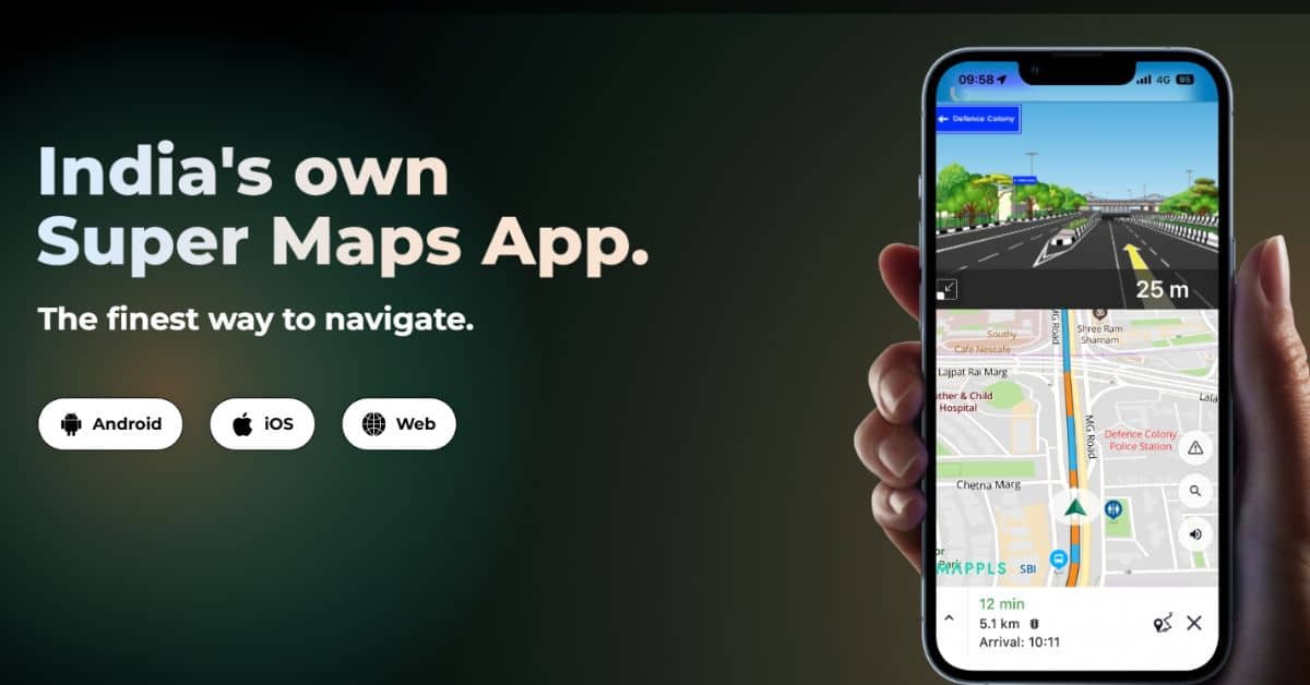
India’s push for homegrown tech has a new star: Mappls, a new navigation app built by MapmyIndia, a company that’s been mapping the country since 1995. This app is like a local hero for finding your way, designed just for Indian roads, cities, and villages. It’s not just maps—it’s a full helper for driving, walking, or biking, with tips on traffic and safety. Union Minister Ashwini Vaishnaw tested it on October 11, 2025, and praised its 3D views and voice guides.
Zoho’s Sridhar Vembu called it “very nice” on October 12, saying it shows years of hard work, even more than apps like Google Maps. With over 35 million downloads, Mappls is free and ready for everyone to download for Android, iOS, and Web.
Mappls teams up with India’s space agency, ISRO, to use satellite photos for super-accurate maps. It’s all about privacy too—no sharing your data with outsiders. The app works offline for basic use, so you can find spots even without a strong signal. It’s available on Google Play and the Apple App Store, and you can download it in seconds.
The app shines on India’s tricky roads, like busy flyovers in Mumbai or narrow lanes in small towns. It gives step-by-step voice directions in nine Indian languages, such as Hindi, Tamil, or Bengali, so it’s easy for anyone to follow.
Swadeshi ‘Mappls’ by MapmyIndia 🇮🇳
Good features…must try! pic.twitter.com/bZOPgvrCxW
— Ashwini Vaishnaw (@AshwiniVaishnaw) October 11, 2025
For drivers, it shows live traffic updates, your expected arrival time, and even toll costs ahead. You can buy toll passes right in the app to skip lines. A special code called Mappls ID or DIGIPIN makes sharing exact spots simple—just six letters for any address, from a big mall to a rural home.
Safety comes first with alerts for potholes, speed bumps, sharp turns, or unsafe areas. It even tracks your car or loved ones with add-on devices, sending warnings if you go too fast or off your path.
For shopping or travel, it has 3D views of busy spots like junctions, indoor guides for airports or stores, and a camera tool to save locations with photos and tags. You can plan trips by car, bike, or foot, and it picks routes that fit—like avoiding tight roads for trucks.
Compared to apps like Google Maps, Mappls knows India better. It has house numbers in villages where others don’t, better traffic from local cameras, and no foreign data worries. Google is great for global spots, but Mappls wins on local details, like shop-level maps or railway ties—the government plans to link it with trains soon.
If you want a simple, safe way to get around India without relying on outside apps, Mappls is worth a try. Download it today and see how it makes your next drive easier. With more updates coming, it’s set to grow big!
Key Features of Mappls App
| Feature | What It Does |
|---|---|
| Voice Navigation | Step-by-step directions in 9 Indian languages |
| Live Traffic & ETA | Real-time updates and arrival time estimates |
| Safety Alerts | Warnings for potholes, turns, and hazards |
| Toll Calculator | Estimates costs and buys passes in-app |
| 3D Junction View | Clear visuals for flyovers and busy spots |
| Mappls ID/DIGIPIN | Easy 6-letter code for any address |
| Offline Maps | Works without internet for basics |
| Indoor Navigation | Guides inside malls or airports |
| Vehicle Tracking | Add devices for family or car safety |
| Trip Cost Estimation | Budgets fuel or power for your journey |